
|
|
I was quite content after the previous two days of storm chasing which resulted in a beautiful mammatus display and stunning gust front structure which completely made the season for me. This was the third day in a row of storm potential and I was game for chasing however I felt so satisfied with yesterday that I didn't feel that strong urge to get out on the hunt. However my instincts wouldn't let me rest so I was back checking the radar and my batteries were charged just in case I needed to leave the house at a moments notice. A good set up with +800 CAPE and LIs of -3, SWly flow with -30 C air aloft, great lapse rates and deep layer shear which meant storms would be organized into multicell lines and local convergence zones increased the chance of funnels and weak tornadoes. I spent the morning watching radar and studying satellite imagery while sorting out my footage from the previous day, suddenly by early afternoon a stunning thunderstorm had exploded to life over Lough Foyle, the storm stretched across much of the lough with multiple red cores in a perfect line with hint of eagle wing radar signature in front indicative of very good wind shear, this storm was highly organized and stunning on radar, it lasted a long time and was producing lightning.
The tail end Charlie cell looked particularly strong with warm air and sunshine all around the rear and for a moment I thought it was going to form a hook echo, I even pondered if there was a funnel cloud or waterspout happening over the Foyle. The storm took its time but eventually moved over the sea and weakened after what looked to be a proud show. I was a little gutted I had to admit, I love that part of the country anyway and getting a big storm there would have been a wonderful experience, I was kicking myself however I had let it go, it was still early in the day so I watched for new developments. By mid afternoon a storm erupted over the Sperrins and moved across the Glenshane/Dungiven area, I was watching radar thinking, should I chase or not?, but something told me to let it go, the sky outside was rubbish with grey flat skies and no light, I suspected the storm would have no visible structure in those conditions so I held back. Then by late afternoon I decided to go chasing, My Mum and our Dog Rhua came out with me for the day, however I didn't have a target area, the models didn't show one particular place better than another so I had to make a careful decision. The sky at home was grey and overcast, solar heating was being shut off so I decided I would need to chase elsewhere, then I recalled that nice sheared storm on the Foyle and I wondered why it was better than anything else on radar, the answer was revealed when I looked at the satellite images, the N and NW section of the country was cloud free and basking in blazing sunshine and blue skies, that was my answer.
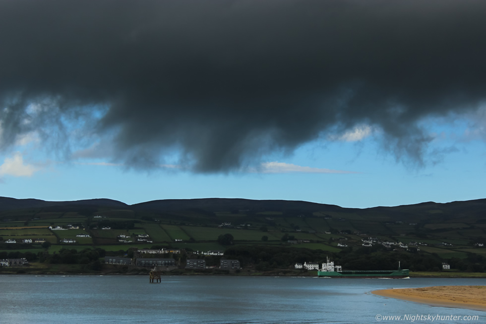
Solar heating was strong in that area plus an on-shore sea breeze meeting the SWly flow off the land was creating a convergence zone which was the perfect breeding ground for convection. I decided I would chase to the NW coast to the vicinity of Lough Foyle as the view is excellent in that area, also there was a huge ship destined to arrive this same afternoon called HOSANGER at 213m in length making this the biggest cargo ship to enter Lough Foyle so I wanted to see her arrive also. We hit the road and drove the entire way under grey skies, clouds, and showery rain, however once we arrived at the coast we where suddenly under glorious blue skies and sunshine, what a transition indeed, the sea breeze was obviously keeping this area clear of residual cloud.
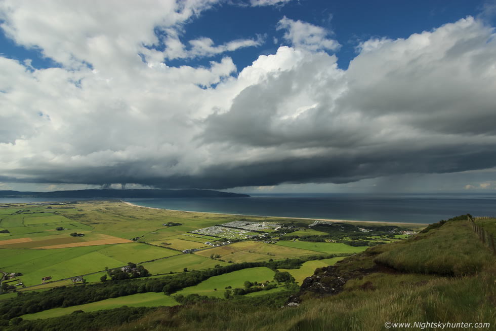 |
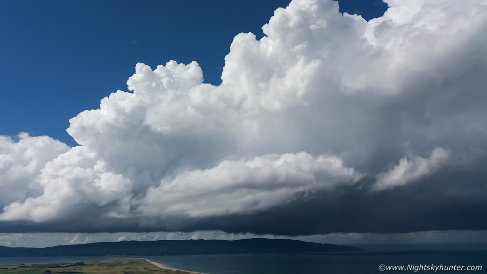
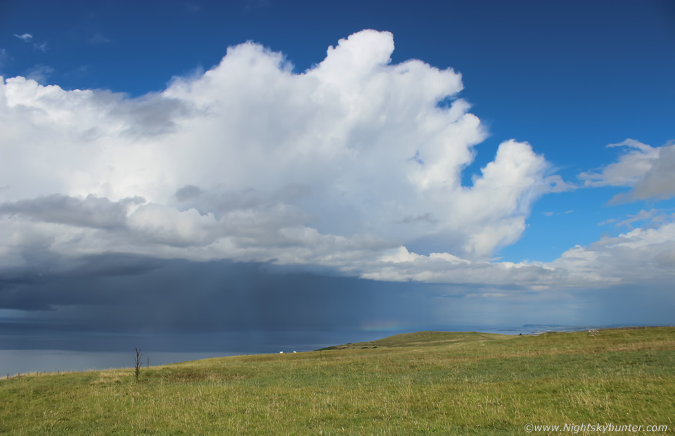
We decided to head to high ground for the best view and opted for Gortmore Viewing Point on Binevenagh and got out for a walk along the edge. The view was truly stunning, vibrant green fields, blue skies and hot sunshine, I mean the sun was burning my skin here, no wonder storms had fired here earlier in this intense solar heating, I lamented on the view we would have had here earlier with the storm over the lough, what a sight it would have been from up here. Behind us to the S facing inland were grey skies however at this location and facing N and NW it was like a proper Summer's day, we sat on the grass and took in the view while baking in the wonderful sunshine. Soon I saw towers forming, at first just small cumulus towers then a few minutes later proper congestus mushrooming skyward and shortly after that it was explosive updraughts, a black base had formed below these and a strong updraught dominated the sky as a multicell thunderstorm was born, this was 10mm wide angle during its birth stage, what a view to witness it all from.
 |
I ran back to the van, grabbed my tripod, then ran back to our location on the warm grass, I attached my 18mm kit lens and began shooting time lapse while shooting a vlog and some footage with my mobile phone in an attempt to capture the atmosphere. This was a phone shot, huge updraughts shooting vertical and expanding in real time, all moving L to R.
 |
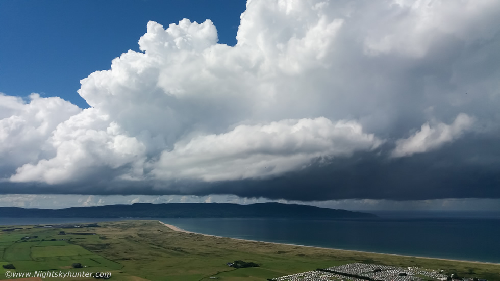
A DSLR shot, this was the kind of moment I love, yesterday had the mean storm structure but today brought the beauty, just check out those enormous towers, these were likely pushing 30,000ft into the Troposphere making these the tallest storm clouds I have witnessed this season. For a sense of scale check out the caravan park to the lower right, imagine the size of a person inside one of those mobile homes and compare to the clouds aloft and prepare to be amazed. Seeing sunlit updraughts surrounded by blue sky in perfect light is rare enough in this country, but seeing this spectacle over such a gorgeous landscape made the experience even more special with Benone beach, Magilligan Point, Lough Foyle, Donegal and Atlantic Ocean complimenting these mighty clouds.
 |
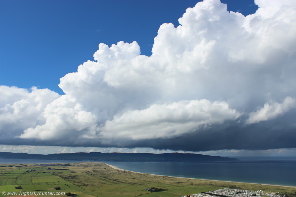
Another phone image, this was a multicell thunderstorm composed of three storm updraughts in a line all connected by a low black base which stretched for miles across the sky. The complex was moving away from Donegal and out over the Atlantic, unknown to me at this time my mate John Fagan was in Donegal having a fishing trip and was watching these very same cells from the other side and shooting time lapse. I could hear distant thunder rumble from across the sea, no lightning observed visually so the electrical activity must have been high up inside the updraught heads and thus of the in-cloud variety, their great height meant the thunder was deep but lower in volume because the sound had to travel downward from a great height which explained its unusual muffled sound to us here.
 |
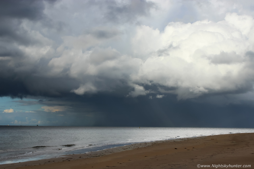
I climbed over the fence and got into the field so I could face more N then began another time lapse at 10mm. The strong shear aloft was now blowing the updraughts over at an acute angle downwind which meant the updraught/downdraught interface was now well separated so the cells had a longer life cycle, this was organized. For a good period the black base looked swollen over the sea, now look at the lowering of cloud under the base at image centre, that's a forming wall cloud (inflow), this is the base of the main cell, to the right of this is precip falling over the sea (outflow), that's all the same cell with excellent separation, the cloud projecting upward to the upper right into blue sky was in the process of anviling out, that's the updraught connected to the base with the wall cloud, can you see how much this cell is leaning (sheared) over now?, it's not often that viewing geometry and visibility allow us to see this so clearly.
 |
Switching over to the kit lens to get in closer, this is a shallow wall cloud, legitimate wall clouds are fairly rare in this country, I think this may be only the third I have seen in years of chasing. Cell moving L to R, sheared tower at upper right is connected to the wall cloud, also check out the line of cloud under the base to the left of the wall cloud, this is most definitely inflow cloud and more likely a tail cloud feeding into the wall cloud. A wall cloud is an abrupt lowering under the rain free base and marks an area of consistent inflow into the cell, their forward edges are often tapered or lean towards the precip as apposed to a shelf cloud which is an outflow feature and tapers away from the precip. A rotating wall cloud can produce funnel clouds and tornadoes, I couldn't tell if this wall cloud had rotation due to its great distance from me however I suspect it was a non rotating wall cloud, however I was hoping a funnel cloud or waterspout was going to drop out from it.
 |
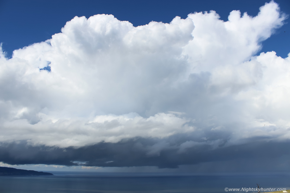
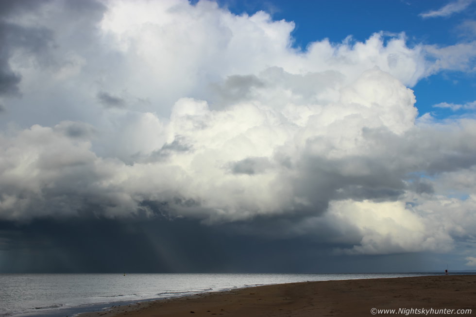
Wide angle shot of all three updraughts leaning forward with rain free base to the left, this was pure heaven to me, standing watching a distant storm in beautiful light with blue skies under intense sunshine, I was actually roasting here, but the joy of watching a storm evolve while standing out in a t-shirt on a hot Summer's day while listening to rumbles as the camera clicked away is nothing short of being my perfect day, I yearn for this every season, for me this is complete happiness.
 |
Kit lens zooming into the forward sector of the multicell, you can see a rainbow on the ocean horizon forming on the precip core, the sky came out so blue in my images I actually had to decrease the blue saturation a little in this image. The storm slowly moved away across the sea, this beauty was a creation of moisture, instability, solar heating, surface convergence, low LCLs and speed shear, what a beauty it was. Sferics charts showed an abundance of lightning from this storm however I never saw a single flash, but multiple distant rumbles and booms did make their way across the sea to our location. The HOSANGER cargo ship was due to arrive anytime, it had just rounded Rathlin Island and was making its way to Lough Foyle, I suspected it was hidden behind the storm's precip core and would come into view at any moment.
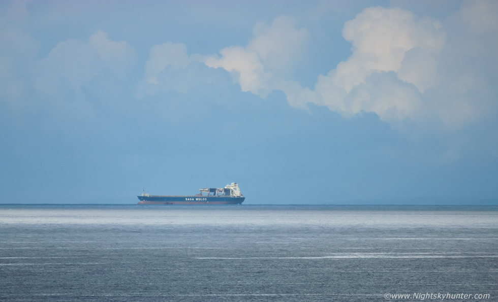 |
We drove to the cliff looking towards Downhill Beach then spotted the HOSANGER emerging from the rain and entering a clearance catching full sunshine, this is her at 400mm and cropped a little, you can see new convection boiling up in the distance behind her.
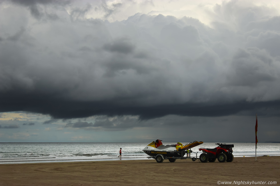 |
We relocated to Benone beach where we enjoyed a hazelnut latte, as I sipped my coffee I observed new convection forming over the sea close to the beach, I could see convergence in action, the inland breeze behind me was clashing with an onshore sea breeze, I watched slow rotation of the scud under forming towers then a new smaller cell formed with updraughts growing higher, it sat close to shore for a while with a nice well defined base, this RNLI jet ski made for some foreground interest, I watched that lowering under the base and wished for it to wrap up into a funnel but it didn't oblige me.
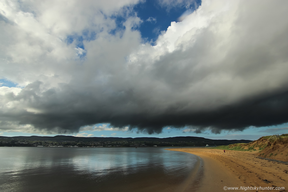 |
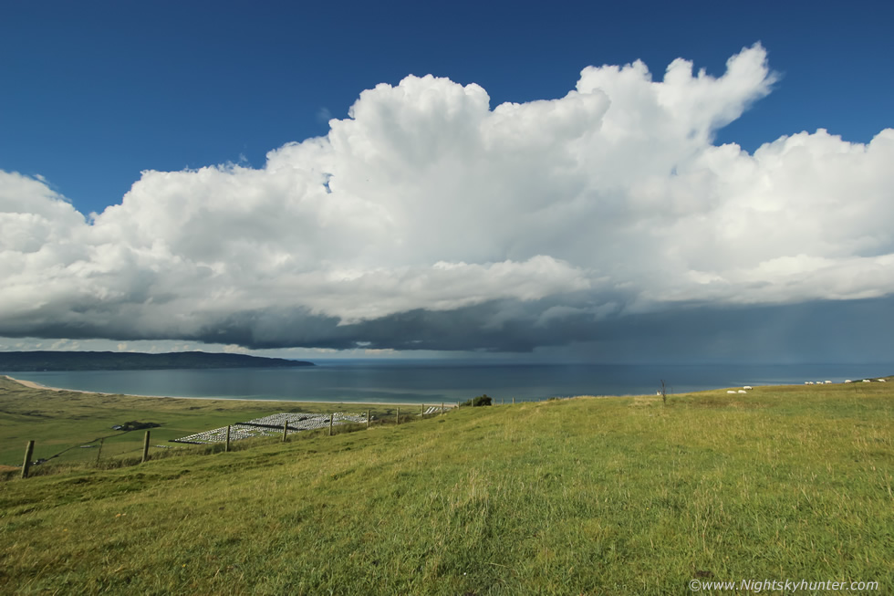
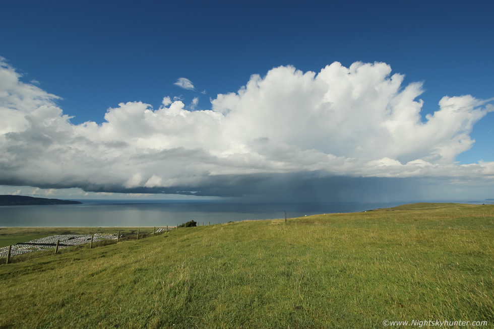
We watched more huge towers erupt over Donegal in the afternoon heat in the same area as the big multicell earlier so we drove to Magilligan Point for a better view. When we arrived the cell was drifting over Lough Foyle heading for the point, I took a few stills from outside the Point Bar at 10mm. This was the flanking area of the cell with big updraught sloping upwards out of frame to the right. Numerous lowerings under the base revealed keen inflow motion and even areas of rotation.
 |
Zooming in to 55m at the base as one of the regular Arklow cargo ships crossed the point heading for open sea. The clouds above were slowly swirling and rotating, it would have been awesome if a funnel cloud had formed just as the ship was passing below, one has to be optimistic!
 |
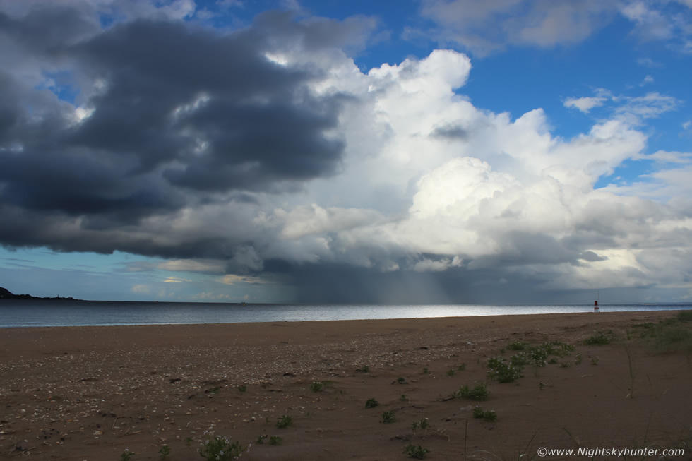
We walked along the beach as far as we could go and watched the flanking area of this newly formed multicell heading out to sea, it wasn't producing sferics however it made for quite a sight with streaks of hail falling down lit by stray shafts of sunlight.
 |
In the clear air to the left of the base where three vessels. The green Arklow on the right heading out, a small fishing boat to the left of the Arklow coming in and to the far left the mighty HOSANGER waiting at the anchorage.
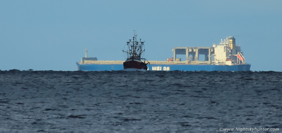 |
Tight crop from a 400mm frame, the 213m HOSANGER and 17m fishing boat, both in sunshine and blue skies while not far from their position heavy rain and hail were falling from the cell.
 |
Wide angle image of the departing multicell. We then went back to Benone and spent over an hour watching bases for funnel clouds during the late evening. At one stage I was certain I observed a tuba type funnel from a base under a tower located at sea, the cloud never condensed into the classic funnel shape however there was an inverted bowl type lowering attached to the base which was clearly rotating, the lowering remained for a good 15 min's or more but never took shape, I would consider it a suspect. We drove back home under a gorgeous red sky at sunset, I have to say this was a most enjoyable chase, not a drop of rain fell on me, I was warm and dry all day and had the pleasure of watching sunlit cells all evening in perfect light and the clouds were beautiful and photogenic, over these last three days I have come home with almost 4000 digital stills from time lapse shooting.
Video featuring vlog and short time lapse sequences of the multicell convection from Gortmore viewing point, I hope you can appreciate the beauty of this moment. The 2017 storm season has now changed for me, these last few days have provided me with awe inspiring sights and great photo opportunities which have left me feeling content, however I'm hoping the season will have something else special to surprise me with before the Summer transitions to Autumn when my attention will turn from inland convection to warmer SST driven coastal convection, thanks very much for reading.
Martin McKenna